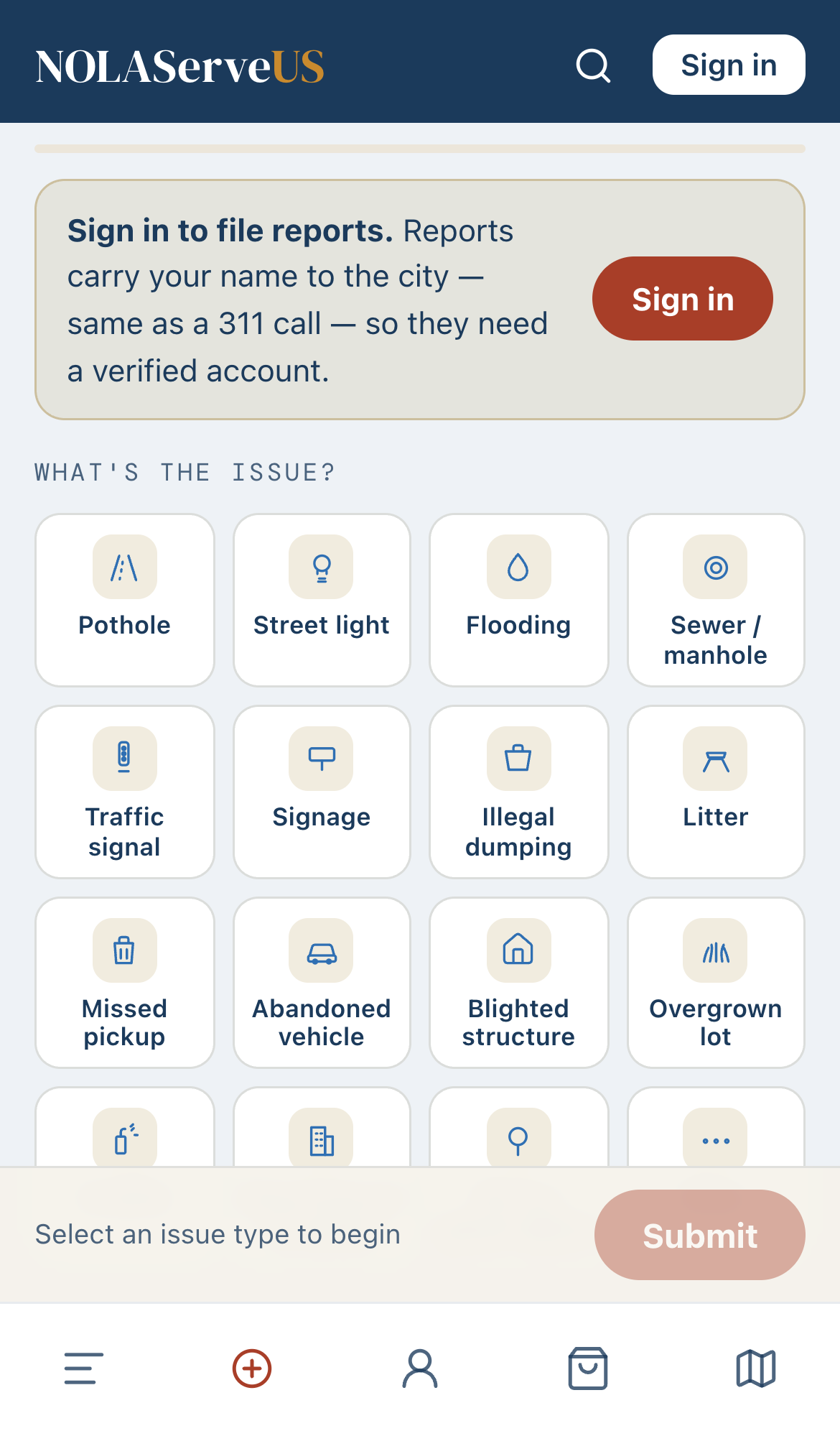
Open Report and pick the issue
Tap the Report tab (the ⊕ in the bottom bar), then choose what's wrong from the grid — pothole, streetlight, flooding, illegal dumping, and more. NOLA ServeUS automatically routes it to the right city department.
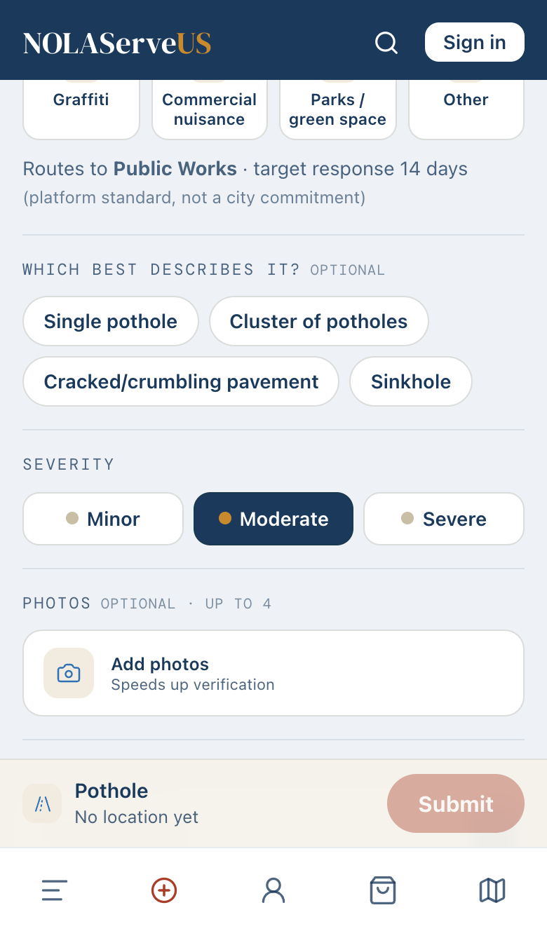
Describe it and set severity
Optionally pick a sub-type (like “single pothole” or “cluster”) and set how bad it is — Minor, Moderate, or Severe. You'll also see the department it routes to and the response target.
Add photos
Snap or attach up to four photos. It's optional, but photos help the city act faster — a clear picture shows the department exactly what they're dealing with.
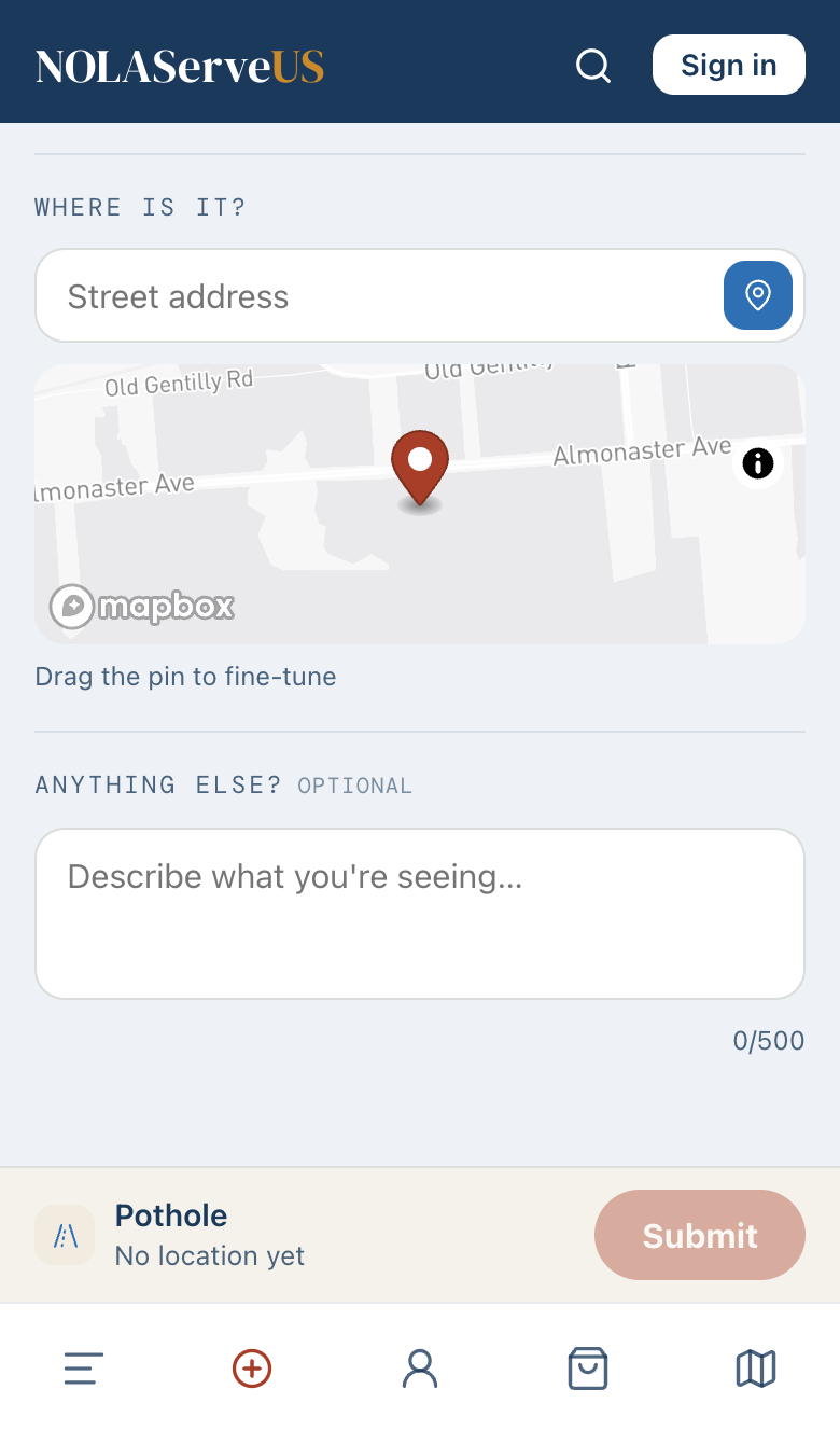
Set the location
Type the street address or drag the pin on the map to the exact spot. This is what puts your report in the right place on the neighborhood map — and in the right council district.
Submit — and watch it work
Tap Submit. Your report lands on the neighborhood map and feed right away, then it's filed with the city's 311 system and paired with a tracking number — and you can follow every update until it's fixed. Neighbors can back your report to push it up the priority list.